Difference between revisions of "File:Baarenhof-Barwalde.jpg"
Jump to navigation
Jump to search
| [checked revision] | [checked revision] |
(Detailed map of Baarenhof and Barwalde, ca. 1910. Source: Archiwum Map Zachodniej Polski http://amzpbig.com/maps/1779_Schoneberg_1910.jpg) |
m |
||
| Line 1: | Line 1: | ||
| − | Detailed map of Baarenhof and | + | Detailed map of Baarenhof, Bärwalde, and Neu-Münsterberg, ca. 1910.<br /> |
| − | Source: | + | Source: [http://amzpbig.com/maps/1779_Schoneberg_1910.jpg Archiwum Map Zachodniej Polski]. |
| − | http://amzpbig.com/maps/1779_Schoneberg_1910.jpg | ||
Revision as of 05:15, 27 August 2014
Detailed map of Baarenhof, Bärwalde, and Neu-Münsterberg, ca. 1910.
Source: Archiwum Map Zachodniej Polski.
File history
Click on a date/time to view the file as it appeared at that time.
| Date/Time | Thumbnail | Dimensions | User | Comment | |
|---|---|---|---|---|---|
| current | 05:14, 27 August 2014 | 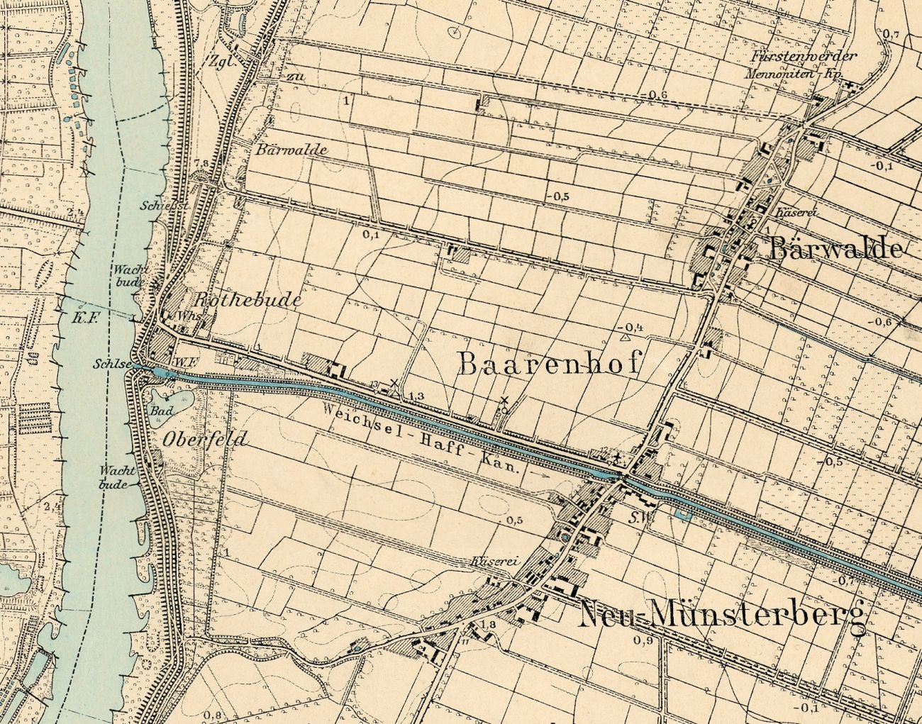 | 1,300 × 1,021 (430 KB) | RichardThiessen (talk | contribs) | Detailed map of Baarenhof and Barwalde, ca. 1910. Source: Archiwum Map Zachodniej Polski http://amzpbig.com/maps/1779_Schoneberg_1910.jpg |
You cannot overwrite this file.
File usage
The following 3 pages use this file: