Difference between revisions of "Noordoostpolder (Flevoland, Netherlands)"
| [checked revision] | [checked revision] |
m (Text replace - "date=1957|a1_last=van der Zijpp|a1_first=Nanne" to "date=1957|a1_last=Zijpp|a1_first=Nanne van der") |
(Forced table of contents to top of page; added categories; added image; added additional information; and added map.) |
||
| Line 1: | Line 1: | ||
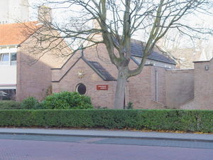
| + | [[File:Emmeloord.JPG|300px|thumbnail|right|Doopsgezinde Kerk, Emmeloord.<br /> | ||
| + | Source: [http://reliwiki.nl/index.php/Bestand:Emmeloord_smeden_doopsgezinde_gemeente-1.JPG Reliwiki].]] | ||
Noordoostpolder (Northeast Polder), an area of 128,520 acres of fertile arable land, was reclaimed from the Zuiderzee, [[Netherlands|Netherlands]], in 1940. On 23 January 1948 the Mennonites living there formed a Kring (circle), which in 1953 became an independent congregation. Services were held biweekly in a rented hall at Emmeloord. H. H. Gaaikema, the pastor of the Harlingen congregation, had charge of this congregation. The baptized membership in 1955 was 41, and in 1957 it was 60. | Noordoostpolder (Northeast Polder), an area of 128,520 acres of fertile arable land, was reclaimed from the Zuiderzee, [[Netherlands|Netherlands]], in 1940. On 23 January 1948 the Mennonites living there formed a Kring (circle), which in 1953 became an independent congregation. Services were held biweekly in a rented hall at Emmeloord. H. H. Gaaikema, the pastor of the Harlingen congregation, had charge of this congregation. The baptized membership in 1955 was 41, and in 1957 it was 60. | ||
| + | = Additional Information = | ||
| + | '''Congregation''': Doopsgezinde Gemeente Noordoostpolder | ||
| + | |||
| + | '''Address''': Smeden 2b, 8301 XH, Emmeloord, Netherlands | ||
| + | |||
| + | '''Church website''': [http://www.dgnoordoostpolder.doopsgezind.nl/ Doopsgezinde Gemeente Noordoostpolder] | ||
| + | |||
| + | '''Denominational affiliation''': | ||
| + | |||
| + | [http://www.doopsgezind.nl/ Algemene Doopsgezinde Sociëteit] | ||
| + | = Map = | ||
| + | [[Map:Doopsgezinde Gemeente Noordoostpolder|Map:Doopsgezinde Gemeente Noordoostpolder]] | ||
{{GAMEO_footer|hp=|date=1957|a1_last=Zijpp|a1_first=Nanne van der|a2_last= |a2_first= }} | {{GAMEO_footer|hp=|date=1957|a1_last=Zijpp|a1_first=Nanne van der|a2_last= |a2_first= }} | ||
| + | [[Category:Places]] | ||
| + | [[Category:Cities, Towns, and Villages]] | ||
| + | [[Category:Cities, Towns, and Villages in The Netherlands]] | ||
| + | [[Category:Churches]] | ||
| + | [[Category:Netherlands Congregations]] | ||
| + | [[Category:Algemene Doopsgezinde Sociëteit Congregations]] | ||
Revision as of 08:11, 26 September 2014
Noordoostpolder (Northeast Polder), an area of 128,520 acres of fertile arable land, was reclaimed from the Zuiderzee, Netherlands, in 1940. On 23 January 1948 the Mennonites living there formed a Kring (circle), which in 1953 became an independent congregation. Services were held biweekly in a rented hall at Emmeloord. H. H. Gaaikema, the pastor of the Harlingen congregation, had charge of this congregation. The baptized membership in 1955 was 41, and in 1957 it was 60.
Additional Information
Congregation: Doopsgezinde Gemeente Noordoostpolder
Address: Smeden 2b, 8301 XH, Emmeloord, Netherlands
Church website: Doopsgezinde Gemeente Noordoostpolder
Denominational affiliation:
Algemene Doopsgezinde Sociëteit
Map
Map:Doopsgezinde Gemeente Noordoostpolder
| Author(s) | Nanne van der Zijpp |
|---|---|
| Date Published | 1957 |
Cite This Article
MLA style
Zijpp, Nanne van der. "Noordoostpolder (Flevoland, Netherlands)." Global Anabaptist Mennonite Encyclopedia Online. 1957. Web. 16 Apr 2024. https://gameo.org/index.php?title=Noordoostpolder_(Flevoland,_Netherlands)&oldid=125364.
APA style
Zijpp, Nanne van der. (1957). Noordoostpolder (Flevoland, Netherlands). Global Anabaptist Mennonite Encyclopedia Online. Retrieved 16 April 2024, from https://gameo.org/index.php?title=Noordoostpolder_(Flevoland,_Netherlands)&oldid=125364.
©1996-2024 by the Global Anabaptist Mennonite Encyclopedia Online. All rights reserved.
